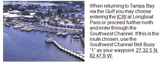
Also if you are sailing down the Gulf the only safe entrance back to the ICW is the Venice Inlet. New Pass and Big Sarasota Pass are always in question as to depth of water and should be avoided.
Proceed out the Manatee River and at Marker #2 set a course for Marker # 68 at the “Bulkhead”. Caution is required at the “Bulkhead” as the water is shallow. Because this is the ICW, Marker “68” is red and passed on your port side. As you pass Marker “62A” look in a southeasterly direction for range markers that are identified on the chart as QR “58” and ISO R 6s 22 Ft. Align yourself with these range markers and proceed down the channel. Continue following the channel markers up to the lift bridge which is called “Anna Maria Island Bridge” (2.8Nm). This bridge is on a schedule of opening on the hour and every 20 minutes after the hour. Notify the bridge tender of your intentions on Channel 9 by providing the boat name, your location, and request the time of the next opening. After completing the passage through the bridge, ahead will be the Cortez Bridge (1.8Nm). It operates on the same schedule and if you time your passage correctly you can make the next opening. On your way there notify the bridge tender of your intentions to pass through and from what direction you are approaching the bridge. (Don’t Waste Time)
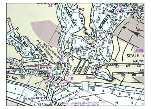
After passing through the Cortez Bridge, proceed down the waterway to Marker “47”.
At Marker “47” (.9Nm) bear right and pass Marker “7” to starboard. Keep the Marker ”LP” to port. LP stands for Longboat Pass, which you are now in. Follow the channel markers. The Longboat Pass Lift Bridge is ahead and opens on demand. When you are half way down the channel notify the bridge tender on CH 9 of your location (East Side) and intent to pass through. This bridge opening is only one lane wide, therefore, align the boat to enter on a centered position. Current can be strong so be alert to flow direction and control the boat with adequate engine power.
Proceed out the channel into the Gulf and continue out to the final marker, which is “MO (A) 16 Ft. 7M “LP.” Having cleared the marker sails can be brought out and a course heading of 152 degrees can be followed. The Venice Waypoint is 27 06.8 N, 88 28.2 W. (22.7Nm)
Marker “1” is located at the outer edge of the Venice inlet.
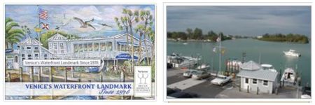
At the Venice Inlet proceed up the channel and observe the current flow direction from the marker pilings. Because the current can run at four knots in this channel you must keep this factor in mind when docking the boat. At Marker “3” call the Crows Nest Marina Dock master on Ch.16. After establishing contact on a working channel to announce your arrival, and listen for docking instructions. Prior arrangements are strongly recommended by calling the Dock master at 941-484-7661, or make your reservation on line http://www.crowsnest-venice.com.
Activities: The Crows Nest Marina is a full service marina along with complimentary bicycles for you to ride into town and browse around. Ask for a map and directions when you check in. You may find a place in town to have dinner or you may want to come back to the marina after your riding adventure and get freshened up utilizing the marina showers. Later in the evening you may wish to enjoy dinner at the Crows Nest Restaurant.
Notes: Planning is essential when making this trip. Arrive early rather than late. Use four (4) nautical miles per hour when estimating time in route. If you’re average speed is greater, so much the better for your estimated time of arrival (ETA).