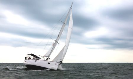
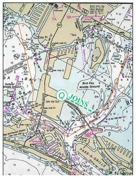
Directions: Begin your day sail trip from the Harborage Marina by using Anchorage # 1 directions and follow them through the east west channel up to Marker “10” or begin the trip from the Pinellas Point Anchorage location.
At Marker “10” (7.4Nm) proceed west through the fixed bridge which has a vertical clearance of 65 feet. Continue down the waterway in a westerly direction. You are heading for the Bascule or Lift Bridge you see in the distance. The bridge is called, Pinellas Bay way Bridge, Structure E. Reference the notes on the chart. This bridge opens on a schedule of either on the hour and/or every 20 minutes after the hour, if there is traffic. To pass through this bridge notify the bridge tender of you intentions by calling him on VHF Ch.9. Identify yourself by the boat name and geographic location (East or West) as to which side of the bridge you are located. The bridge tender will respond on Channel 9 as to the time the bridge opens. Note the time per your watch and be in position to transit the bridge upon its opening. The opening is wide enough for boats to pass port to port however depending on the mast height you may not want to crowd the sides of the channel, because the sections of the bridge do not raise to a complete vertical position. Upon completing the passage through Structure E (3.2Nm) a call back to the bridge tender on Ch. 9 is appreciated.
Proceed NW on a heading of 312 degrees for (.5Nm) where Marker QR “24” will be on your starboard side. Turn in a northerly direction and the Pinellas Bay way Bridge Structure C will be ahead of you. Upon reaching the bridge use the same procedure to notify the bridge tender of your intentions, as you need to pass through this bridge also.
Proceed through the opening (1.2Nm) and continue on a heading of 352 degrees. Your next course will be established by using ranges.
Using your Tampa Bay Chart find the Don Caesar hotel symbol, this is on the beach west of your location. Now find the marina symbol east of your location. Using your parallel rule draw a line between the two symbols and find the magnetic heading that you will follow east. The heading is 074 degrees. Continue in the channel and observe the pink hotel bell towers to port and the marina to starboard.
When you cross the line of sight between them, bear right leaving the channel (.2Nm) and head directly for the left-hand corner of the marina, on a heading of 074 degrees. Your water depth will be 20 plus feet. Look astern, as you want to keep the hotel directly on your stern and the bow on the left side of the marina. Upon reaching the marina (.6Nm) take a new heading of 054 degrees. Water depths will quickly recede to 7 feet. A Waypoint of 27.44.0 N, 82 41.6W is your anchorage.(1.6Nm) .
Activities: The Boca Ciega Yacht club is located in the little bayou just north of your location. Channel marker “1” & “2” are NW of you.
Leaving: When leaving the anchorage, follow the reciprocal of your route or you can follow the channel noted on the chart out of the bay. Be aware the north end of the bay has some shallow areas that protrude south and are close to the channel.